Adventure Guides
Explore History and Nature at Tranquil Red Clay State Park

Located off the beaten path in the southwest corner of Bradley County and just a few miles from Apison, Red Clay State Historic Park offers an opportunity to learn about the region’s Native American history while providing a peaceful setting in which to experience nature.
Covering 263 acres of gently rolling forestland and open meadow—once pastures and cotton fields—the park is the site of the last seat of the Cherokee Nation, between 1832 and 1837. The Cherokee capital was relocated there from New Echota, Georgia, after the state of Georgia banned political activity by the Cherokee. Eleven councils, attended by up to 5,000 people, were held here before the 1838 enforcement of the Indian Removal Act of 1830 resulted in the infamous Trail of Tears event, in which the Cherokee were forced to relocate to Oklahoma.
According to one source, over 90 buildings once existed at Red Clay. Efforts to preserve the site began in the 1960s. The Red Clay Council Grounds were named to the National Register of Historic Places in 1974. Red Clay State Historic Park was created in 1979 and recently celebrated its 40th anniversary.
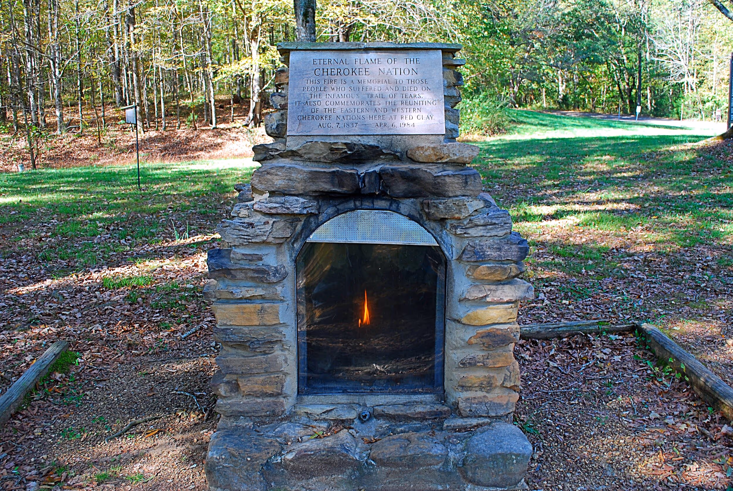
In 1984, nearly 150 years after the Cherokee’s forced removal, the park hosted the 1st Joint Council of the Cherokee Nation and the Eastern Band of the Cherokee Indians. The event was marked by the return of the eternal flame, which honors an estimated more than 4,000 who died on the Trail of Tears. The propane-fueled flame can be found in a small stone monument on the park grounds.
Twenty-five years after the first meeting, the two tribes met for a 2nd Joint Council at Red Clay. Then in August of 2017, the 175th anniversary of the removal, all three federally recognized bands of Cherokee, the two previously mentioned and the United Keetoowah Band, met here for the first time in the Tri-Council of the Cherokee. The Cherokee consider Red Clay to be sacred ground.
A popular activity at the park is to hike the 1.7-mile Council of Trees Trail. The trail forms a loop, which can be hiked in a clockwise direction by starting behind the 500-person capacity amphitheater, located uphill to the left of the picnic pavilion. Or, it can be hiked in the opposite direction by starting at the trailhead immediately behind the pavilion.
The trail meanders among rolling hills, some rising 200 feet above the narrow valleys, and through typical deciduous forest, where it’s quite possible to spot the occasional white-tailed deer or other wildlife. If hiking counter-clockwise, in about 1 mile you’ll encounter the highlight of this trail, the imposing stone overlook platform. When the forest is green, the view from the overlook is basically of the surrounding trees, but in winter the Blue Ridge Mountains can be seen on the eastern horizon.
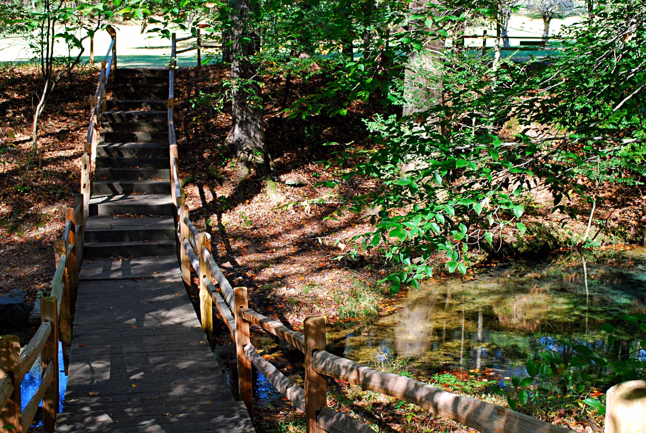
At about 0.45 miles beyond the overlook and 0.15 mile before arriving back at the amphitheater, you’ll reach a trail junction, with the main trail continuing straight on to the amphitheater and the 0.15-mile Connector Trail turning right. Here you have the option of following the Connector Trail through a more bottomland-type forest with pine trees and sections of boardwalk, until it connects to the 0.2-mile Blue Hole Trail.
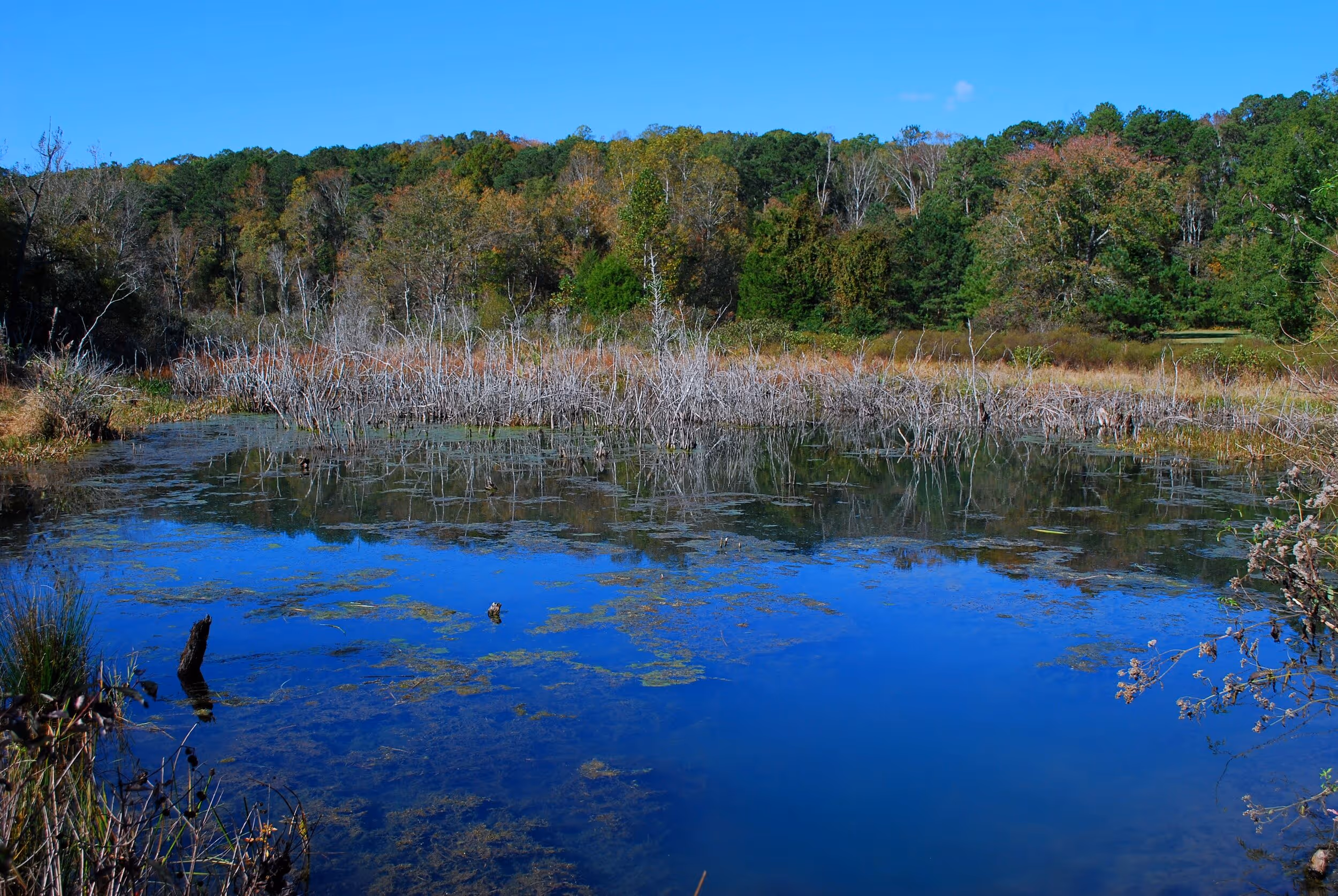
Turn right from the Blue Hole Trail and skirt the edge of the open meadow if you want to check out the sizable beaver pond you may have noticed when driving into the park. Here, beavers have created habitat for ducks and other wildlife by damming up the water that flows from the Council Spring.
Returning across the meadow, the trail passes several log structures that replicate a farmhouse, barn and corn crib similar to those on Cherokee farms in the early 19th century. There are also three small cabins of the type that served as sleeping huts when the Cherokee met here and a pavilion that depicts the council house used for meetings.
Another of the park’s primary features is the Council Spring, formerly known as the Blue Hole Spring. The spring, which was the water supply for the Cherokee during council meetings, is a deep, clear pool where a copious amount of water flows continuously from beneath a limestone ledge. The stream eventually flows into Mill Creek, a tributary of the Conasauga and Coosa rivers system.
The park’s James F. Corn Interpretive Facility (or visitor center), houses exhibits on the 19th-century Cherokee, the Trail of Tears and Cherokee art, and features a video theater, a gift shop and a small library.
While Red Clay State Historic Park may not be known particularly as an outdoor recreation destination, it’s a great place to learn about an important part of the region’s history, as well as to immerse yourself in nature on a hike through tranquil forests.
Click here for the park visitor center’s hours of operation, as well as directions and contact information. The park opens daily year round at 8:00 a.m. For closing time, which varies at different times of the year, call 423-478-0339.
See a detailed map of the park and its trail system here.
Learn more at Red Clay State Park’s website.
More Like This

Tired of Sitting in Traffic on Chattanooga Interstates?

Scenic Alternate Routes Available to Commuters