Adventure Guides
Find Your Adventure at Fall Creek Falls State Park

A Bit of History
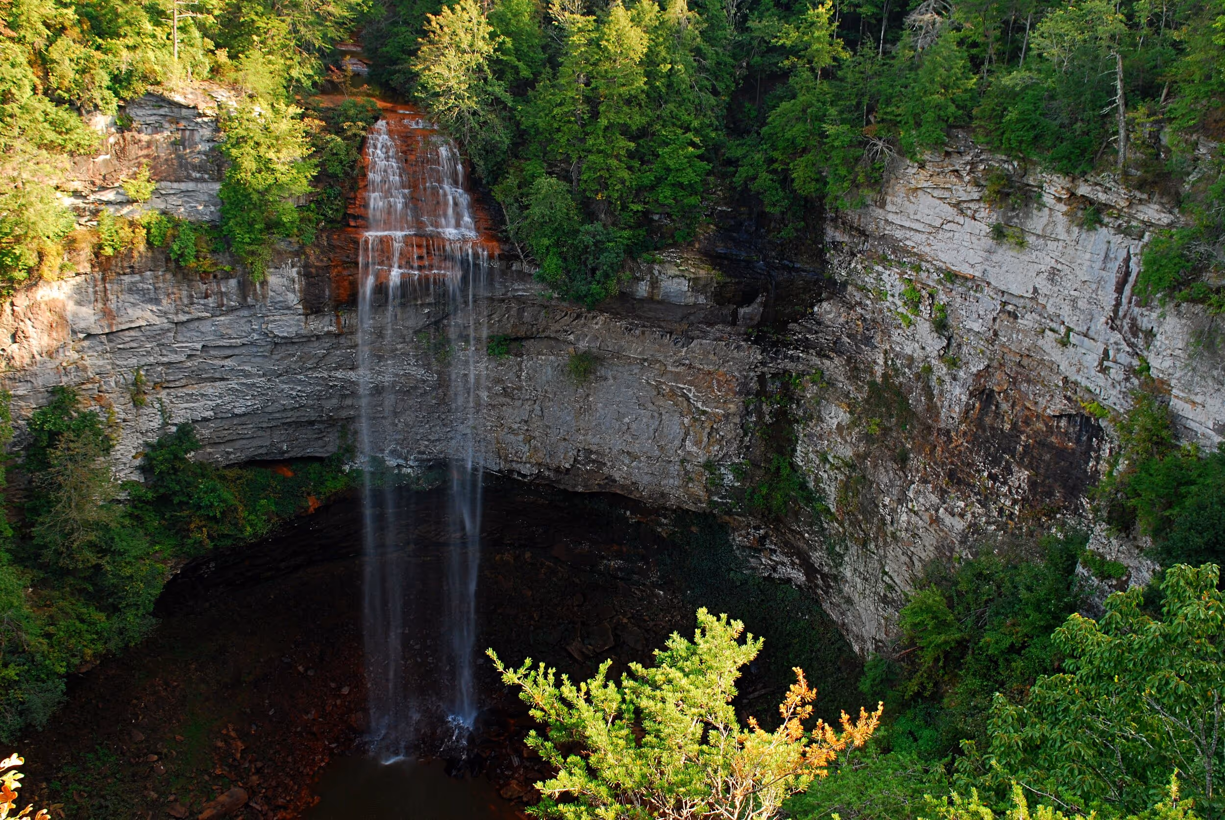
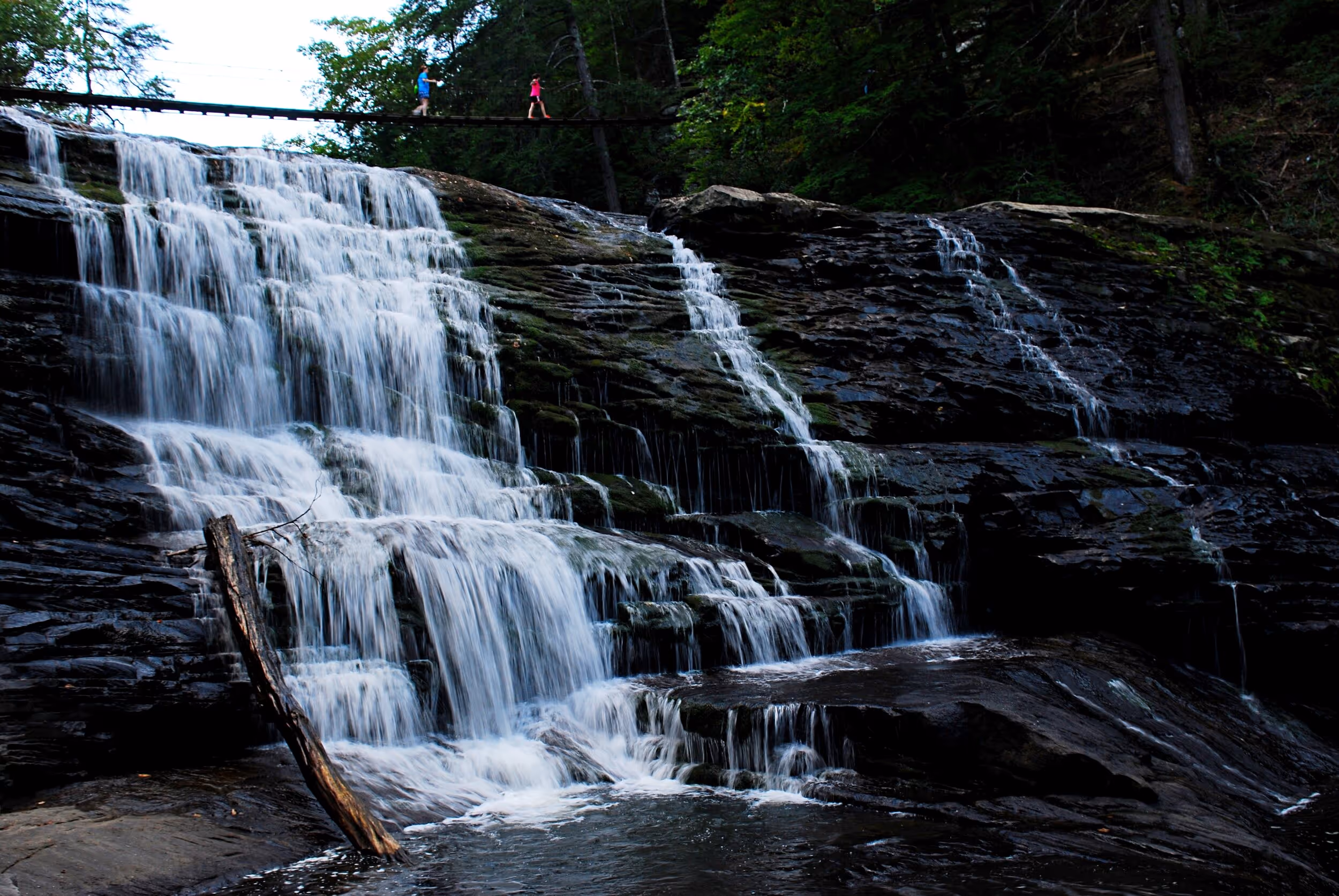
Fall Creek Falls State Park, located on the Cumberland Plateau about 75 miles north of Chattanooga, is one of Tennessee’s largest and most visited state parks. The park’s namesake falls, at 256 feet, is one of the highest free-fall waterfalls in the eastern United States. There are a half-dozen or more other notable waterfalls in the park as well. The scenic Cane Creek Gulf is another major natural feature, carved by Cane Creek as it cuts its way off the plateau.
The federal government began buying up degraded land in the area in the 1930s, followed by years of restoration and construction work by the Works Project Administration and the Civilian Conservation Corps. The National Park Service transferred ownership of the land to the state in 1944.
In 2006, about 12,500 acres, which includes a chunk of Cane Creek Gulf, were added to the park, with the total now being over 29,000 acres. The new addition adjoins the Bridgestone/Firestone Centennial Wilderness and Wildlife Management Area, which, along with the Virgin Falls State Natural Area; Bledsoe State Forest; and a Boy Scout reservation, creates over 52,000 acres of nearly contiguous protected lands.
A Cornucopia of Recreation Opportunities
When it comes to outdoor recreation, Fall Creek Falls State Park offers something for everyone.
Hiking
With over 56 miles of hiking trails, available options range from short, fairly easy hikes to a couple of overnight backpack trails.
A popular short hike takes the Woodland Trail, which begins behind the nature center, crosses a 150-foot-long suspension bridge, then follows the 0.7-mile Gorge Overlook Trail, and after side trips to three scenic overlooks rejoins the Woodland Trail 0.3 miles before reaching the Fall Creek Falls Overlook. Returning via the Woodland Trail completes an approximately 2-mile hike. From the Fall Creek Falls Overlook, a 0.7-mile (round-trip), somewhat-strenuous hike will take you to the base of the falls, something highly recommended if you’re feeling in shape.
A couple of relatively new trails on the recently added tracts are the 1.5-mile Wheeler Farm Loop in Cane Creek Gulf and the 3-mile (one way) Prater Place Trail, which takes hikers through Camps Gulf to Hemlock Falls.
Biking
In addition to 3 miles of paved bike trail, mountain bikers can access over 24 miles of trail, including both dual-track and single-track options.
On the Water
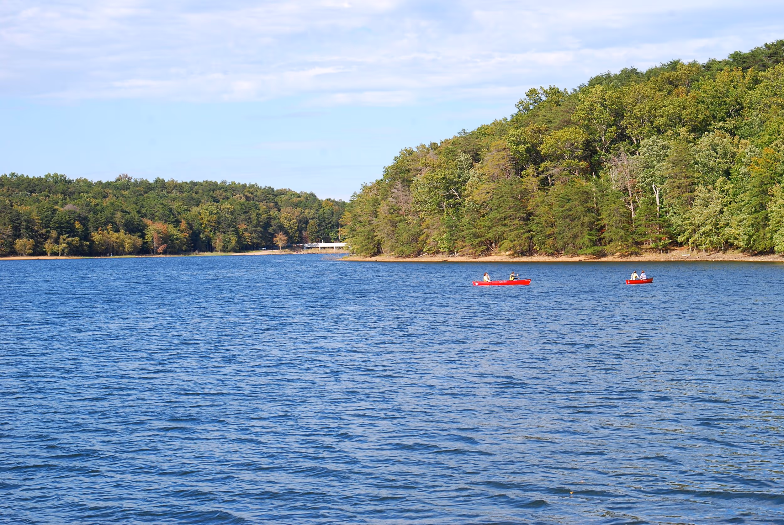
The 345-acre Fall Creek Falls Lake provides fishing for bass, catfish and bluegill. Aluminum fishing boats can be rented year-round, while paddleboats, kayaks, and canoes are available from April through October. You can bring your own canoe or kayak year-round.
Zip-Line
The Canopy Challenge Course provides a self-guided zip-line adventure with over 70 aerial obstacles and 6 different routes. It also offers mountain bike rentals.
Climbing
Copperhead Rock is a popular site for climbing, including both top roping and rappelling, with both beginner and more advanced routes. A free permit is required.
Golfing
The park’s 18-hole golf course is considered by some to be one of the top 25 public courses in America.
Driving Tour
One of the park’s most popular features is a self-guided scenic driving tour with a number of overlooks, including the expansive view of Cane Creek Gulf from Millikan’s Overlook. Much of this view has been preserved by the recent additions to the park.
Camping
For overnight stays, there are 222 RV/tent campsites, 2 group camps, 30 cabins, and 2 group lodges. The Fall Creek Falls Inn, Conference Center, and Restaurant is currently being rebuilt. It’s expected to possibly reopen in 2021.
In addition, a new park headquarters and camper welcome center is under construction, with the hope of being open sometime in the fall of 2019.
Besides a variety of naturalist-led programs, the Betty Dunn Nature Center, which has recently undergone extensive remodeling, has interpretive displays, books, maps and more.
One of the park’s features that many visitors may be unaware of is the fire tower located on Bradden Knob, in the northeast corner of the southeastern part of the park. It is reachable via 1.5 miles or so of unpaved road. The gate at the turnoff to the tower is usually closed, but you can park there and walk between a quarter and a half-mile with a 200-foot climb up the gravel road to the tower. The deck atop the tower provides a panoramic 360 degree view of the surrounding countryside. A word of caution about fire towers like this one: Unless it’s the dead of winter, it’s a good idea to be alert for wasp, hornet, or yellow jacket nests, especially underneath the observation room floor.
Hunting
It should be noted that hunting is allowed on 7,000 aces of the original park lands, with several three-day deer hunts in November and December, a nine-day turkey hunt in April and squirrel hunting December through February. Check with TWRA for schedules or with park staff for hunt areas, as they may be closed to other users during scheduled hunt dates. The newly added lands, which don’t contain developed trails (except for the Wheeler Farm Loop and the Prater Place Trail), are open for hunting in accordance with regular statewide seasons.
View a good trail map here.
For directions and more information, visit the park’s official website.
More Like This

Tired of Sitting in Traffic on Chattanooga Interstates?

Scenic Alternate Routes Available to Commuters