Adventure Guides
Cherokee Removal Memorial Park - A Look into the Tragic History of the Trail of Tears

Blythe Ferry, on the eastern shore of Chickamauga Lake near the confluence of the Hiwassee and Tennessee Rivers, is the site where William Blythe began operating a ferry in 1809 as a crucial river crossing on the “Great Road” between Knoxville and Chattanooga. The 1835 Treaty of New Echota transferred all Cherokee land east of the Mississippi to the United States and called for the relocation of the Cherokee to Oklahoma. In 1838 during the infamous Cherokee Removal, also known as the Trail of Tears, around 9,000 Cherokee were gathered for crossing the river at Blythe Ferry. A severe drought caused water levels to be very low, which resulted in a wait of up to six weeks for many to cross the river, where they were then forced to march west during the worst winter on record in Tennessee.
The Cherokee Removal Memorial Park, located adjacent to the Blythe Ferry site on a 29-acre section of the Hiwassee Wildlife Refuge, was dedicated in 2005 to commemorate the tragedy inflicted upon the Cherokee and to honor their culture.
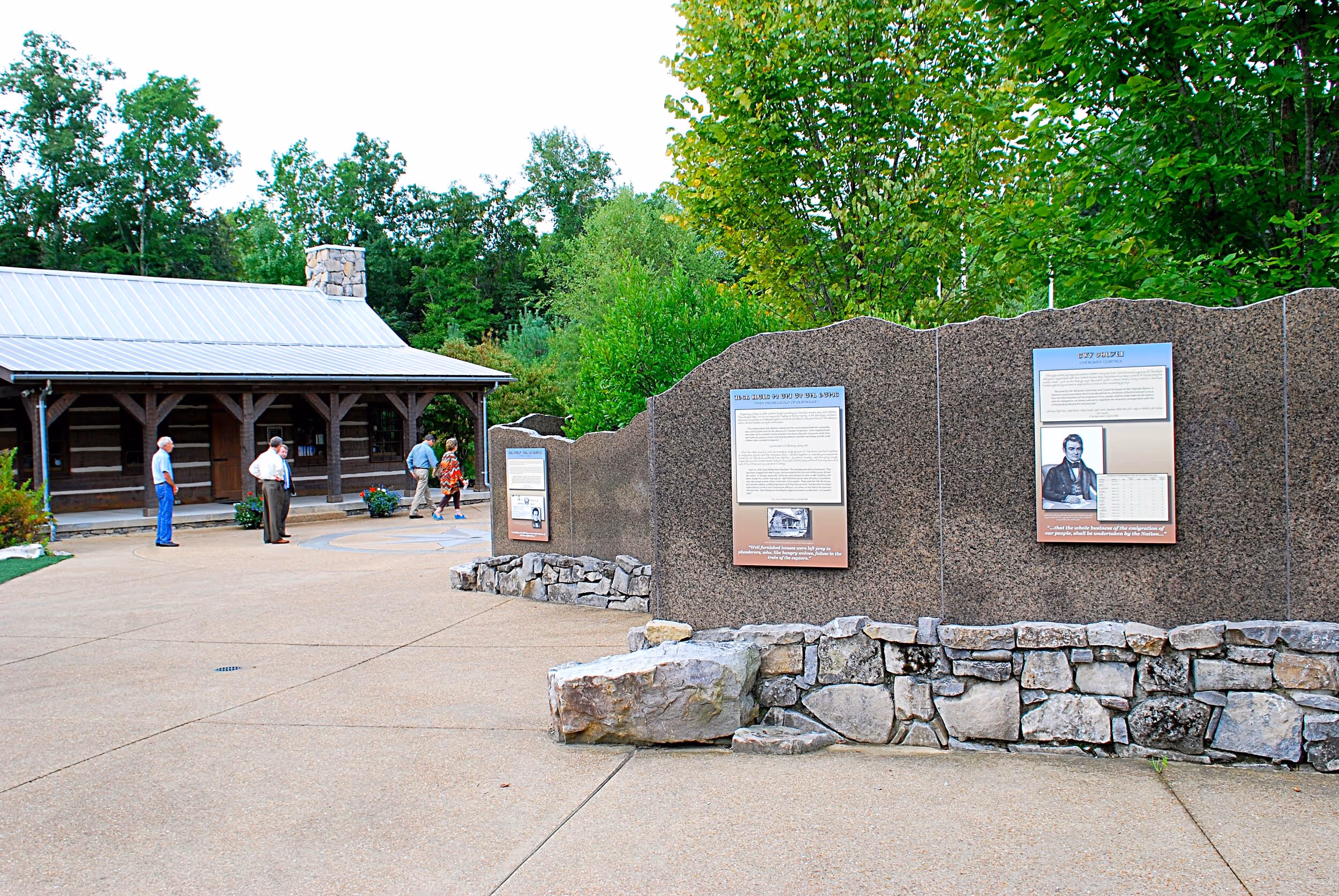
A log cabin replica of the type of homes the Cherokee lived in at the time of the Removal contains a visitor center, comprising a library, office, meeting room, interpretive area, and restrooms. In addition to providing information about Native American history, Trail of Tears documentation, local history, archeology, and wildlife, the library assists visitors in tracing their Cherokee ancestry.
An outdoor History Wall provides information about the early culture and history of the region’s Native Americans, how hunter-gatherers developed a literate and civilized culture and government, and how they were eventually forced to give up their land and relocate to Oklahoma.
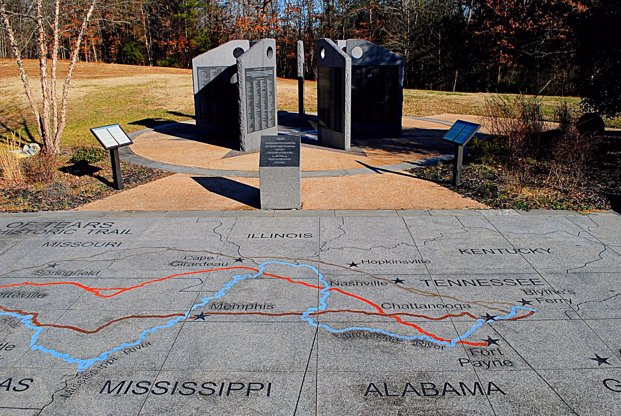
The various land and water routes taken by the Cherokee on the removal to the west are depicted on a map engraved on the sunken floor of an outdoor amphitheater.
A Memorial Wall by the amphitheater is laid out on a seven-point star which represents the seven clans of the Cherokee. It contains 2,535 names of those identified as head of households in the 1835 Census, as well as some household members. Around 4,200 of the 16,542 Cherokees listed in the census died as a result of the 1838 Removal.
“This is the closest thing to a headstone they will have. The Memorial is intended to humanize them.
— Shirley Hoskins
According to a local Cherokee resident, Shirley Hoskins, “This is the closest thing to a headstone they will have. The Memorial is intended to humanize them. They were not wild savages, but were at least as civilized as most that replaced them. They were farmers, mechanics, weavers, spinners, and businessmen. Many were literate in Cherokee and/or English.”
A Prime Wildlife Viewing Spot
While the park’s primary purpose is to educate the public about the forced removal of the Cherokee from their ancestral land, it is also a great place to appreciate the wildlife that now thrives there.
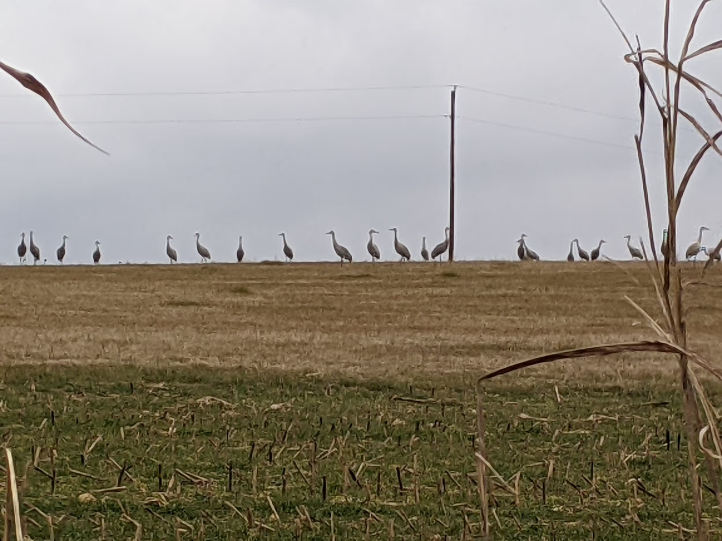
In recent years, a nearby part of the 6,000-acre Hiwassee Refuge has become a popular location for viewing large flocks of wintering sandhill cranes, especially during the Tennessee Sandhill Crane Festival, held each year in January. Up from just 20 birds in 1968, over 14,000 of the cranes now gather there each winter, the largest winter flock of sandhill cranes in the southeastern U.S. (outside of Florida). Though present from November through February, their numbers tend to peak in January. Learn more about the Hiwassee Refuge here.
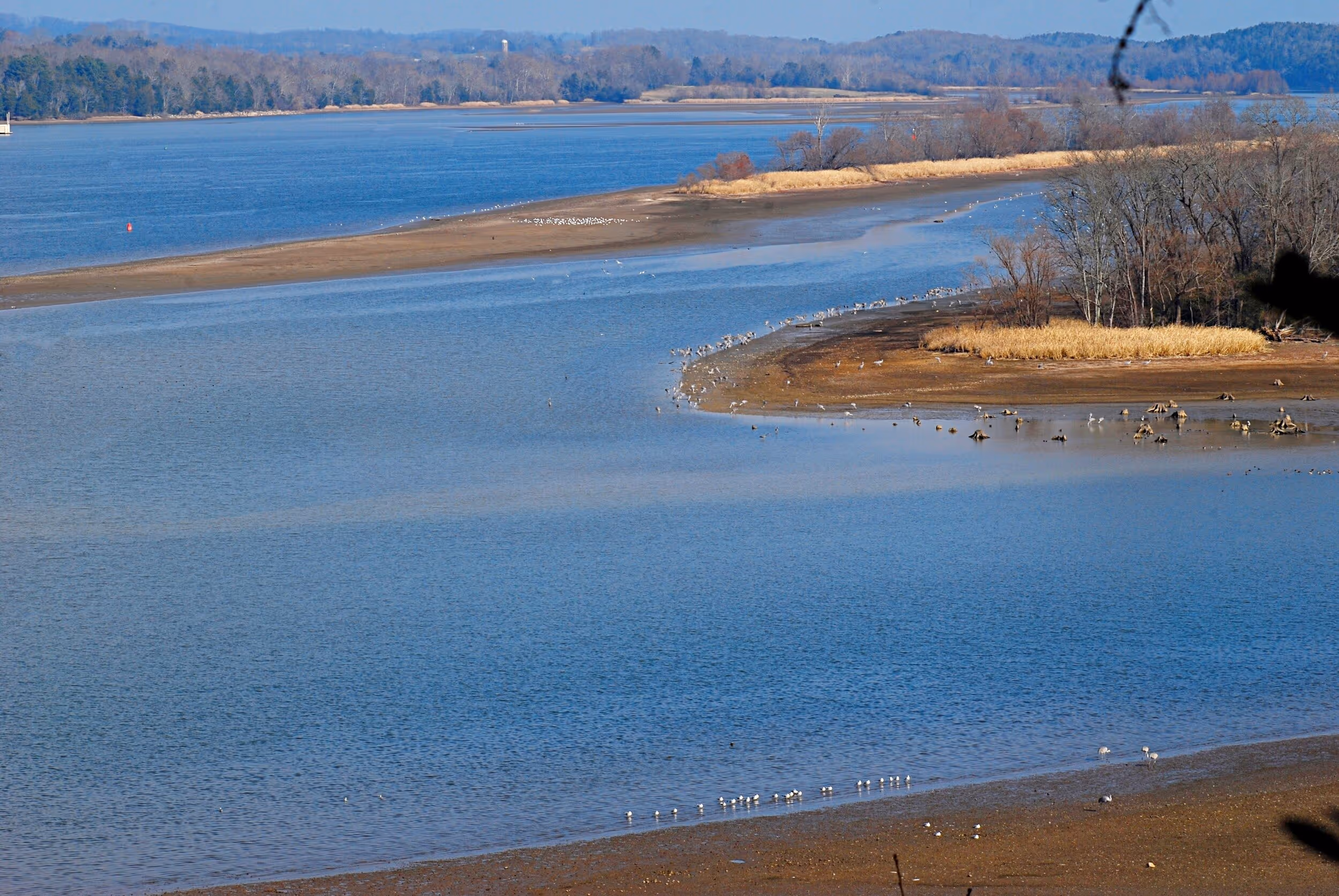
Many visitors to the Hiwassee Refuge include a stop at the Cherokee Removal Memorial Park, which, in addition to the history-oriented features, provides a roofed overlook on a high bluff above the Tennessee River. The overlook, a short walk or drive from the Memorial site, affords a view of the river and part of the 400-acre Hiwassee Island (also part of the Hiwassee Refuge), and is a good spot for seeing cranes, bald eagles, and other birds. Ospreys, great blue herons, cormorants, gulls, a variety of ducks, greater white-fronted geese, and white pelicans are among the species that have been spotted from the overlook. Many of these are observed while gathered on the sandbars and shorelines of Hiwassee Island and the far riverbank.
Hiwassee Island, also known as Jolly’s Island, was about twice its current size before the formation of Chickamauga Lake and was occupied by humans for hundreds of years. In addition to early Hamilton, Mississippi, Dallas, Creek, and Cherokee cultures, its residents once included a young Sam Houston, who was adopted by Chief John Jolly. It was visited by the Desoto Expedition in 1540. Union troops stored grain on the island during the Civil War. TVA sponsored an extensive archeological investigation there in the 1940’s before the creation of Chickamauga Lake. The Tennessee Wildlife Resources Agency plants grain crops on the island and the nearby shore to support migrating waterfowl.
In addition to the overlook, a trail leads from behind the visitor center a short distance through the woods to the shore of a bay, which is another good location for spotting cranes and other birds.
The park is also a designated eBird Hotspot.
Picnic tables are available for the convenience of visitors.
The Cherokee Removal Memorial Park is operated by Meigs County. While the grounds are open daylight hours year-round, the visitor center is open Wednesday through Saturday 8:00 a.m.-4:00 p.m.
More Like This

Tired of Sitting in Traffic on Chattanooga Interstates?

Scenic Alternate Routes Available to Commuters